Treacherous Tunnels: Difference between revisions
No edit summary |
No edit summary |
||
| (One intermediate revision by the same user not shown) | |||
| Line 5: | Line 5: | ||
| | | | ||
| Wiki Map File = | | Wiki Map File = | ||
| ACmaps.com ID = 02C5 | | ACmaps.com ID = 02C5 | ||
| Coordinates = 71.2S, 93.7E and 75.0S, 90.3E | |||
| Coordinates = | |||
| Landblock = 02C5 | | Landblock = 02C5 | ||
| Dereth Map = | | Dereth Map = | ||
| Line 16: | Line 13: | ||
|75.0|S|90.3|E| | |75.0|S|90.3|E| | ||
}} | }} | ||
| Nearest Town = | | Nearest Town = MacNiall's Freehold | ||
| Nearest LS = 71.2S, 93.7E | | Nearest LS = 71.2S, 93.7E | ||
| Route = Take exit from [[Jungle Shadows]] | | Route = Take exit from [[Jungle Shadows]] | ||
| Level Restrictions = Any | |||
| Level Restrictions = | | Tieable = Yes | ||
| Tieable = | | Recallable = Yes | ||
| Recallable = | | Summonable = Yes | ||
| Summonable = | | Lifestone if Log = | ||
| Lifestone if Log = | |||
| Quest Flag = | | Quest Flag = | ||
| | | | ||
| Line 31: | Line 27: | ||
}} | }} | ||
== | == Notes == | ||
== Maps == | == Maps == | ||
* {{ACMaps.com|02C5}} | * {{ACMaps.com|02C5}} | ||
* Wiki Map: | * Wiki Map: | ||
:[[ | :[[:Category:Unmapped Dungeons|Unmapped Dungeons]] | ||
== NPCs == | == NPCs == | ||
Latest revision as of 17:03, 14 September 2017
| Maps NPCs Creatures Items and Objects Portals Images Update History |
| Treacherous Tunnels | |
|---|---|
| Quests | None |
| Restrictions | Level: Any Tieable: Yes Recallable: Yes Summonable: Yes |
| Coordinates | 71.2S, 93.7E and 75.0S, 90.3E near MacNiall's Freehold |
| Nearest LS | 71.2S, 93.7E |
| Route | Take exit from Jungle Shadows |
| Map Files: | ACMaps Map |
| 02C5 | |
Notes Edit
Maps Edit
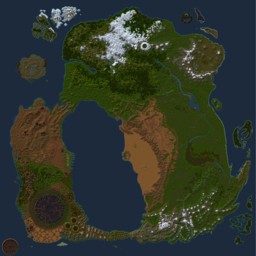
- Map (from ACMaps.com)
- Wiki Map:
NPCs Edit
- None
Creatures Edit
Items and Objects Edit
- ??
Portals Edit
- Surface - near drop and at the end, see map
Images Edit
Click image for full size version.
-
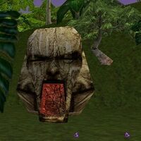
Entrance to the Treacherous Tunnels
-
Caption


